Kgatswane - North West
Well it is exactly one month before we kick off the Drakensberg Grand Traverse and Iwano, Kobus and Myself together with other company decided to get together again for a little hike to talk and share some ideas on food, gear, tips and what have you on doing an unsupported hike through the Maluti mountains in March this year. We all got together in one of the Magaliesberg range reserves, Kgaswane bordering the city of Rustenburg in the north west province, a little more that a hour's drive from Joburg. We started our hike from Naga camp (natural enviroment in Tswana) in the south westerly corner of the reserve. It was a scourching day as usual in these parts of the world and the sweat was pouring at this stage. We proceeded through some natural bush and through various valleys that is the home to some wildlife such as Zebra, Eland, Blesbok, Ribbok and the very elusive Sable antelope. After 4 hours hike we reached the waterholes to our delight. It was time for a definate cool off and then some lunch next to a spectacular view of the Magalies in the distance stretching all they way to Harties. It was time to push on to Witkruis base camp in the North western side of the route. We were somewhat challenged by the not so flat sections on the route and was quite a surprise for me as I did not reallize that this flat part of the world had such asscents. Good training at least for the Drakensberg I would imagine. After all the up and down we reached a natural forest section about 2km from Witkruis camp wich is quite dense but very beuatiful. Surrounded by the Magalies berg we descended into the final stretch towards camp. Happy campers were we as we got to a well looked after campsite with everything you need to relax in this tranquil enviroment. Bedbunks, wood, kettle, water and toilet-first class I would say. During our dinner preparations the talk was all about our route planning, what is the best gear i.t.o 4 seasons ontop of a mountain, food ideas, map studying etc. I guess that one can never be to prepared and your worrying feel inside will just not subside. Up the next morning at 6:00 and starting breakfast. Its already hot and the sun is not even out yet, going to be long day today. On our way back to Naga camp we had to get out of the valley and climb our way up the 200m ascent throught the bush and all the way along the contours of hills onto the grasslands hosting the Zebras and Rooibok. No trees here at least not big enough to hide from the sun a little. 50+ Factor sunscreen is probably a good idea if your're worried about a bit of sunburn. We made our way to what is known as the "highest point" on the far western side of the reserve. Here you have a nice view that stretches far into the distance and you wonder what the "boere" was thinking when they were roaming these parts hundered of years ago on foot and horseback. We dropped off the mountain and hiked along the western contours of the mountain past some loudmouth shacma baboons and some large "botter spinnekop" This is quite unbelievable to think that there are still some places one can go and hike for around R120 not to far away from home and still feel and experience nature to its fullest. Cant wait to be standing ontop of the Thabana Ntlenyana peak soon
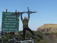
Hiker per excellance

Teamwork getting up some rock faces

No teamwork geting up the rockface

Group fotie before the swim

The waterfall pools, awesome

Nice view just before Witkruis

Witkruis camp

View from "higest point"

What a beaut!!!

posted by nick @ 3:48 PM
0 Comments
![]()
![]()